The town of Dunkirk is located in the department of Nord in the extreme northern tip of France approximately 12 kilometres from the Belgian border. During the First World War Dunkirk was a major port of debarkation for the British Expeditionary Force in September and October 1914. Throughout WWI it was a seaplane base and later an American Naval Air Service base. The town was also a French hospital centre and the 8th Canadian Stationary Hospital was there from November 1918 to April 1919. Although an estimated 7,500 shells and bombs fell on the town during the war, ship building and other port activities continued. During the Second World War, Dunkirk was the scene of the historic evacuation of the British Expeditionary Force from France in May 1940.
During the Second World War, Dunkirk was the scene of the historic evacuation of the British Expeditionary Force from France in May 1940.
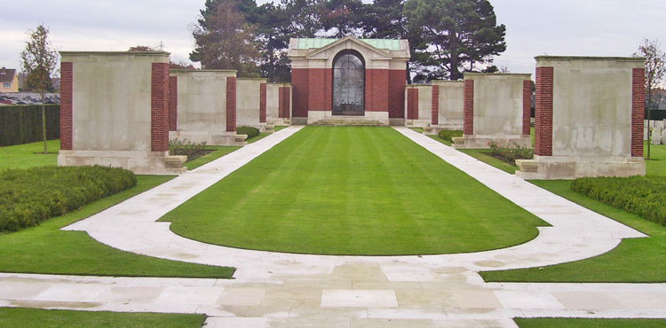
The DUNKIRK MEMORIAL stands a the entrance to the Commonwealth War Graves section of Dunkirk Town Cemetery. It commemorates more than 4,500 casualties of the British Expeditionary Force who died in the campaign of 1939-40 or who died in captivity who were captured during this campaign and who have no known grave.
The memorial was designed by Philip Hepworth and unveiled by Queen Elizabeth II on 29 June 1957. The engraved glass panel, depicting the evacuation, was designed by John Hutton.